August 6th
The plan was to meet Kelly at Boulder Creek RV Park where there were 2 safe pens for Issy and Gillette -Kelly’s horse.

After spending most of yesterday getting Kelly’s trailer to Cold Water Campground we finally were able to load up and head to Onion Valley where the trailhead to Kearsarge Pass was.
The PCT was only 7
miles from the parking lot where we left the trailer but it was all up: from
the basin floor at Boulder Creek of 3,200’ to over 11,800’ at Kearsarge Pass
and Kelly and her horse were showing the elevation gain in less than 5 miles.  I
stopped several times hoping that the slower pace would work to our advantage
but Kelly was having a migraine and Gillette looked lost. Issy and I were well
acclimated to the change but Kelly left 100’ at home just two days before so
there was little chance that they could continue all the way to Kearsarge Pass
in one day.
I
stopped several times hoping that the slower pace would work to our advantage
but Kelly was having a migraine and Gillette looked lost. Issy and I were well
acclimated to the change but Kelly left 100’ at home just two days before so
there was little chance that they could continue all the way to Kearsarge Pass
in one day.  I feared that Kelly might not even be able to go on at all as her
headache was getting worse and I really didn’t want her in full blown elevation
sickness. I had seen Port with serious elevation sickness in Yellowstone many
years ago, along with Burton getting ill – it was not a scenario I wished to
repeat. So I offered to go back to the trailer which would drop us to around
9,000’ but Kelly is one tough cookie and she wanted to try to push on. It was
hard to read someone as athletic and fit as Kelly especially since she
displayed such stoic determination to continue and I think she was trying to
hide just how bad she was so I decided that we should stop at one of the
several lakes on the way up.
I feared that Kelly might not even be able to go on at all as her
headache was getting worse and I really didn’t want her in full blown elevation
sickness. I had seen Port with serious elevation sickness in Yellowstone many
years ago, along with Burton getting ill – it was not a scenario I wished to
repeat. So I offered to go back to the trailer which would drop us to around
9,000’ but Kelly is one tough cookie and she wanted to try to push on. It was
hard to read someone as athletic and fit as Kelly especially since she
displayed such stoic determination to continue and I think she was trying to
hide just how bad she was so I decided that we should stop at one of the
several lakes on the way up.

Fortunately, we came
to a small one above Big Pothole Lake which had a little graze and some very
fine camping spots under the shadow of Kearsarge Pass. This was around 10,000’
and I hoped it would be low enough so both Kelly and Gillette could get
acclimated overnight. We set up camp and I found I had forgotten to bring any
books (imagine 10 days with nothing to read!), my tree saw and, heaven forbid,
my big blue spoon for mixing beet pulp. Kelly said she had forgotten to bring
any way to light her stove (bic lighter) so I decided I would go back to the
trailer (only 5 miles and all down) and gather up our forgotten items. While Kelly
grazed the horses I hurried down Mount Gould allowing the trail to pull me into
a run.  In less than an hour I passed many hikers who we had passed going up and
they showed their amazement that I was heading back for a “Blue Spoon” and
books! I got to the trailer and having located all
our stuff, headed back up and it wasn’t long before I realized I had forgotten
to get a couple of lighters for Kelly. So I started to ask some of the downhill
traffic if they could spare one…sure enough, a girl and her father who had
hiked two 10,000’ peaks earlier that day were leaving the trail at Onion Valley
and gave me one. I was more than
grateful as I certainly wasn’t going back to the trailer another time. I
arrived in camp to find Kelly in her tent and she really didn’t sound well but
she said she was “okay.” Kelly had dinner ready and it wasn’t anytime at all
when we both fell into our tents.
In less than an hour I passed many hikers who we had passed going up and
they showed their amazement that I was heading back for a “Blue Spoon” and
books! I got to the trailer and having located all
our stuff, headed back up and it wasn’t long before I realized I had forgotten
to get a couple of lighters for Kelly. So I started to ask some of the downhill
traffic if they could spare one…sure enough, a girl and her father who had
hiked two 10,000’ peaks earlier that day were leaving the trail at Onion Valley
and gave me one. I was more than
grateful as I certainly wasn’t going back to the trailer another time. I
arrived in camp to find Kelly in her tent and she really didn’t sound well but
she said she was “okay.” Kelly had dinner ready and it wasn’t anytime at all
when we both fell into our tents. 
The horses never made a sound until around 1
when Issy woke me for his night snack. Both Gillette and Issy ate and drank as
I enjoyed the night sky. 
I looked forward to this quiet time every night on the
trail where I could sit in awe and gratitude that I was again in the wonderful
Sierra Mountains. The overflow from the lake babbled and the falling stars
jetted across the sky almost on command. How is it that I am so very fortunate?
August 7th
We broke camp and I wasn’t sure Kelly felt any better
although she said she did. Gillette certainly was doing better and Issy was a
freight train! We climbed out of the bowl, following the trail over countless
rocks but always heading up.  Finally, at the top of Kearsarge Pass we were
rewarded with views on all sides but we didn’t stay as we now had to try to
make up the time lost from not getting that far yesterday. The trail started to
go down after following along just under the ridge and we took the first trail
heading towards some lakes. It wasn’t long before I realized that we had taken
the wrong trail although the trail we were on did get us where we wanted horses
were prohibited from being on it.
Finally, at the top of Kearsarge Pass we were
rewarded with views on all sides but we didn’t stay as we now had to try to
make up the time lost from not getting that far yesterday. The trail started to
go down after following along just under the ridge and we took the first trail
heading towards some lakes. It wasn’t long before I realized that we had taken
the wrong trail although the trail we were on did get us where we wanted horses
were prohibited from being on it. 
We were too far down the mountain to go back
and I decided that the impact from just going back would be just as bad as
continuing on to the PCT. We skirted a
couple of lakes and enjoyed the descent towards Vidette Meadows where we
stopped to rest the horses for a few minutes. We mounted up and rode down Bubbs
Creek Trail encountering a forest ranger who stopped us to inspect our permits.
I had a through pass but Kelly wasn’t covered under it and according to the
ranger we needed bear canisters for the horse feed. Although we both had bear
cans which could hold a good bit of horse feed along with our feed the ranger
told us we couldn’t continue without having canisters for their feed and Kelly
had to obtain a permit. I hung horse feed for years and never have had any
problems but the rules in King’s Canyon were to use bear canisters so I was
quite sure we could obtain some at the Cedar Grove Pack Station where we had
our resupply and as for Kelly’s permit the ranger said we could get one there
as well. 
While the ranger was lecturing us about grazing policy (ignoring the
fact that we highlined and fed our horses) a pack string came up with several
mules and it appeared that holding them up was a real problem for the string.
Kelly and I listened patiently to the ranger allowing him to go on for at least
15 minutes about the grazing until the packer finally told him it was getting
dangerous for his string to be held up so long. That seemed to help things
along and the ranger told us not to continue on without the proper canisters
and grazing information. Luckily for us Tom and Dirk were from Cedar Grove Pack
and we were able to ride easily behind them not having to worry about the
trail.  Their mules, knowing that they were heading home, covered the trail at a
fast clip, only stopping for water once and we quickly fed our two horses. The trail was over grown in several places and
it was enough for me to be thankful that we were following them and didn’t have
to constantly be checking the map. Issy seemed amused by the big packs but didn’t
like the mules and ground his teeth at them if they were too close. Gillette
just trouped on as if nothing fazed him.
Their mules, knowing that they were heading home, covered the trail at a
fast clip, only stopping for water once and we quickly fed our two horses. The trail was over grown in several places and
it was enough for me to be thankful that we were following them and didn’t have
to constantly be checking the map. Issy seemed amused by the big packs but didn’t
like the mules and ground his teeth at them if they were too close. Gillette
just trouped on as if nothing fazed him. 
We stayed close to the creek for most
of the ride with large rock formations soldiering us along. 
We crossed over a bridge and then before long we were at a trailhead 5 miles from Cedar Grove Pack Station, luck again was with us as Lee from the station offered us a ride back so we didn’t have to travel along a blacktop road with no shoulders. Arriving at the pack station was a stroke of good fortune as we were offered dinner, a large paddock for the horses who had all the alfalfa they could eat and we even had a cabin to sleep in. We told Tim and Maggie, the owners about the ranger encounter and it seemed like no surprise to them but they took it all in stride offering to take Kelly to get her permit and I decided that we would be better off if we hired one of their crew to pack our things back up to the PCT as we had lost 7,000’ in elevation getting there. Having them pack us out would solve the bear canister problem and then we would be out of the area that required them. Kelly and I relaxed in the cabin with Kelly sleeping on the bed and me on my mat on the floor. I slept soundly knowing that the horses had plenty to eat for the entire night only waking up when the wind blew through the gaps of the floor into my face!
August 8th
I was up early and escaped to the camp kitchen since the
light was on. I had to read my maps and be sure we had things in order for the
next 10 days. Luckily, I was offered a cup of coffee and a place to stretch out
my maps. I wanted to get with Tim on the location of the “allowed” grazing
areas and known water. I also wanted to unload more of what Issy and Gillette
were carrying since Kelly and I were paying for a mule and packer to accompany
us. It ended up that they had to take 3 mules to carry all the extra but for me
it was well worth it as Issy would have enough work to carry me and my camping
equipment to Castle Domes at around
9,000’ and then tomorrow to Pinchot Pass at over 12,000’.  Kelly and I got our things together as the
camp seemed to just meander around then all of a sudden they were ready to
leave! It was apparent that they had done this so many times that their system
only took a few minutes whereas Kelly and I had to jump to it to catch up. We travelled 15 miles, passing many day hikers,
a few distance hikers and several families going to Mist Falls.
Kelly and I got our things together as the
camp seemed to just meander around then all of a sudden they were ready to
leave! It was apparent that they had done this so many times that their system
only took a few minutes whereas Kelly and I had to jump to it to catch up. We travelled 15 miles, passing many day hikers,
a few distance hikers and several families going to Mist Falls.  A family was
taking pictures from up in a tree and tried to get us to pass under the limb…but,
of course we didn’t until they climbed down.
A family was
taking pictures from up in a tree and tried to get us to pass under the limb…but,
of course we didn’t until they climbed down.  The scenery was stunning and following along
the south fork of Woods Creek was difficult but well worth the circuitous route
back to the PCT.
The scenery was stunning and following along
the south fork of Woods Creek was difficult but well worth the circuitous route
back to the PCT.  We went over granite steps for miles always gaining elevation and
I noticed how hard the mules had to work. The last mule, a gray one named
Granite, was always pulled along.
We went over granite steps for miles always gaining elevation and
I noticed how hard the mules had to work. The last mule, a gray one named
Granite, was always pulled along.  It wasn’t that Granite didn’t want to go but
more like he never had a chance to see where to place his feet and often he was
rudely jerked by the mule in front of him especially at the switch backs. I
felt sorry for him but soon realized that he carried the lightest load. It must
be a tough life for these animals having to travel this same trail several
times a week.
It wasn’t that Granite didn’t want to go but
more like he never had a chance to see where to place his feet and often he was
rudely jerked by the mule in front of him especially at the switch backs. I
felt sorry for him but soon realized that he carried the lightest load. It must
be a tough life for these animals having to travel this same trail several
times a week.  I was glad to be doing it once but wouldn’t like to repeat the
performance on a regular basis. Dirk, the packer, was a big fellow who drew on a
bottle of booze in his pommel pack with worrisome frequency. He seemed to
hesitate and not remember a creek crossing and my confidence in him was waning
until he led us to a wonderful green meadow where the evidence of other packers
was clear.
I was glad to be doing it once but wouldn’t like to repeat the
performance on a regular basis. Dirk, the packer, was a big fellow who drew on a
bottle of booze in his pommel pack with worrisome frequency. He seemed to
hesitate and not remember a creek crossing and my confidence in him was waning
until he led us to a wonderful green meadow where the evidence of other packers
was clear.

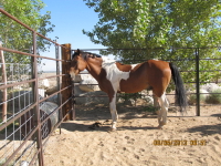
We all untacked the animals; Dirk turned his pack string loose as did Kelly. But knowing Issy I put on hobbles and even then he had a tendency to leave camp.

No sooner then I started to set up my tent when Issy took off running, hobbled and all, passing up the other horses and heading down the trail. Visions of having to go the whole 15 miles back to Cedar Grove flashed and I found the highest running gear I think I ever had trying to catch up with him. He had a good ¼ mile advantage but at least the hobbles made him work very hard to maintain his quick pace and it wasn’t long before he stopped enough for me to get alongside of him. He didn’t resist but just put his head down and let me take him back to our camp. With that episode, Issy sealed his fate about being loose and I would never trust him again. There just isn’t another horse as independent and to pass up all the other horses and head out on his own told me I better stick with that policy. Finally, we settle in at Castle Domes and relaxed for the evening.
August 9th
Last night Dirk slept in his bedroll with Kelly and me using
our tents and while we were breaking them down a bear came close in.  The pack
string alerted to it and then they took off chasing it right out of sight! We
continued to pack up and another bear came in from a different direction. This
time the pack string was far off and the bear seemed to know he had an open
invitation to scavenge our camp. Kelly and I raised our voices and the bear
slowed and then ambled off only to circle around and try to come in from
another direction. Finally, we were up and riding out knowing that we had to
climb Pinchot Pass at 12,130’ some 7 miles up trail.
The pack
string alerted to it and then they took off chasing it right out of sight! We
continued to pack up and another bear came in from a different direction. This
time the pack string was far off and the bear seemed to know he had an open
invitation to scavenge our camp. Kelly and I raised our voices and the bear
slowed and then ambled off only to circle around and try to come in from
another direction. Finally, we were up and riding out knowing that we had to
climb Pinchot Pass at 12,130’ some 7 miles up trail.  There were many big
boulders getting to Pinchot but the pass itself wasn’t any problem and Kelly
and I dismounted and walked down the other side as we often did to reward the
horses for such a long, hard climb.
There were many big
boulders getting to Pinchot but the pass itself wasn’t any problem and Kelly
and I dismounted and walked down the other side as we often did to reward the
horses for such a long, hard climb.  We
switched backed down working our way through the rocks and rough terrain.
We
switched backed down working our way through the rocks and rough terrain.  We
passed Lake Marjorie and went on to the Bench Lake trail where we originally
were to camp but decided to push on and see if there wasn’t some place closer
to the trail. Bench Lake was almost 2 miles off trail. After 4 miles we crossed
the South Fork Kings River and found a small trail dropping down where there
was a slight bit of graze and plenty of camping spots. We pulled off, made camp
and high-lined the horses. Dirk did the same and we fed the stock.
We
passed Lake Marjorie and went on to the Bench Lake trail where we originally
were to camp but decided to push on and see if there wasn’t some place closer
to the trail. Bench Lake was almost 2 miles off trail. After 4 miles we crossed
the South Fork Kings River and found a small trail dropping down where there
was a slight bit of graze and plenty of camping spots. We pulled off, made camp
and high-lined the horses. Dirk did the same and we fed the stock.  They seemed
to be very happy to be still but I was a bit nervous as I thought the spot we
chose was rather sensitive and even Kelly kept looking around for something
more horse friendly. I began to repair Issy’s boots since he was wearing the
toes out at an incredible rate on the granite. I brought several spare parts
to repair them but only one extra boot. Kelly tried to tend to her very sore
feet with Gillette acting like a veteran trail horse, just sleeping on the
high-line as did Issy. We did have water
from South Fork Kings River and a little graze so we settle in.
They seemed
to be very happy to be still but I was a bit nervous as I thought the spot we
chose was rather sensitive and even Kelly kept looking around for something
more horse friendly. I began to repair Issy’s boots since he was wearing the
toes out at an incredible rate on the granite. I brought several spare parts
to repair them but only one extra boot. Kelly tried to tend to her very sore
feet with Gillette acting like a veteran trail horse, just sleeping on the
high-line as did Issy. We did have water
from South Fork Kings River and a little graze so we settle in.
Dirk was up and packed by 8 as he thought he might just try
to go all the way back to Cedar Grove but he had reservations about the rough
terrain he had to go back over. We hated to see him go as he gave us a feeling
of security let alone the extra weight his stock carried for us but he had come
4 miles farther than planned and he had other commitments at the pack station.
We got loaded and started to ride but it wasn’t long before I realized we had
to be on the wrong trail…the trail maintenance just wasn’t up to PCT standards
with trees over the trail and no signs of the usual heavy PCT traffic. We
headed back up to where I was sure the PCT was and crossed the Kings River once
again; I then studied the trail which dumped right into the river with rocks on
the other side showing no signs of the trail. It was no wonder I led us off as
the trail south seemed evident but the PCT was not. It turned out the south
bound trail was the South Fork Trail and the PCT went northeast and upstream. We passed Cardinal Mountain (which got the
name from the red and white rocks resembling a cardinal cap,) numerous small
lakes and came up to a Boy Scout troop with one of the leaders asking if we had
anything for giardia. It seemed that the troop leaders had it but the scouts
didn’t. I looked for my grape seed extract, as I didn’t have any I offered my
satellite phone if they thought it was necessary to get help. They declined and
we all went on our way.  I had woken up
this morning after fretting about Mather Pass all night. I guess I obsess about
keeping Issy safe and try to run through as many scenarios as possible. Was the
pass wide enough for both horses and hikers? Did I need to wait for a hiker to
announce our horses coming up the pass or could the southbound hikers see us?
Was it too steep to ride straight through? Were there any resting areas for the
horses to catch their breath or would we have to just stop on the narrow
trail? Were the switchbacks wide enough to safely turn? Mistakes at 11,000’
could be fatal and the horrendous death of two fine horses belonging to an
acquaintance a couple of years ago still haunted me. Those horses should have
never died and if their rider had been more conservative they wouldn’t
have. But, Mather Pass proved to be a
relatively easy pass except for the huge rocks we had to climb to get to it.
The rocks were jetting right out of the trail bed and even forward going Issy
had had enough when we came to one very large boulder shelved 3 feet up in
front of us. He pulled left then right…any way not to have to jump up but
finally from a standstill he gathered himself and exploded upward. It was one of those times that he just
shocked me with his incredible strength and although we had several other
massive boulders to climb none was as bad as that one. At the top of Mather
Pass, a gal offered to take our picture so we posed and enjoyed the views.
I had woken up
this morning after fretting about Mather Pass all night. I guess I obsess about
keeping Issy safe and try to run through as many scenarios as possible. Was the
pass wide enough for both horses and hikers? Did I need to wait for a hiker to
announce our horses coming up the pass or could the southbound hikers see us?
Was it too steep to ride straight through? Were there any resting areas for the
horses to catch their breath or would we have to just stop on the narrow
trail? Were the switchbacks wide enough to safely turn? Mistakes at 11,000’
could be fatal and the horrendous death of two fine horses belonging to an
acquaintance a couple of years ago still haunted me. Those horses should have
never died and if their rider had been more conservative they wouldn’t
have. But, Mather Pass proved to be a
relatively easy pass except for the huge rocks we had to climb to get to it.
The rocks were jetting right out of the trail bed and even forward going Issy
had had enough when we came to one very large boulder shelved 3 feet up in
front of us. He pulled left then right…any way not to have to jump up but
finally from a standstill he gathered himself and exploded upward. It was one of those times that he just
shocked me with his incredible strength and although we had several other
massive boulders to climb none was as bad as that one. At the top of Mather
Pass, a gal offered to take our picture so we posed and enjoyed the views.  We
descended with fierceness, struggling to make each foot fall land on something
stable, finally getting to upper Palisade Lake where we followed the lake along
the side wall, crossing a stream and finding many hikers resting along the shore
of another lake. Following the east shore of this second lake we quickly got to
the “Golden Staircase” – why it was named that was a mystery because the rough
and difficult cliff descent was anything but golden. The cliffs were basically
blasted to accommodate the tiny trail and the switchbacks were extremely tight
with boulders all along the way. We passed along side of Palisade Creek which
was raging and beautiful and finally were at the bottom where the forest showed
signs of fire
We
descended with fierceness, struggling to make each foot fall land on something
stable, finally getting to upper Palisade Lake where we followed the lake along
the side wall, crossing a stream and finding many hikers resting along the shore
of another lake. Following the east shore of this second lake we quickly got to
the “Golden Staircase” – why it was named that was a mystery because the rough
and difficult cliff descent was anything but golden. The cliffs were basically
blasted to accommodate the tiny trail and the switchbacks were extremely tight
with boulders all along the way. We passed along side of Palisade Creek which
was raging and beautiful and finally were at the bottom where the forest showed
signs of fire  but was regenerating with new trees and green grass. We arrived
at Deer Meadow, a fair meadow with graze and decided to camp right there. The
horses had a chance to eat grass and then we high-lined them between 2 trees
close to our tents. I had a habit of always setting up my tent so I could see
Issy in case he got into trouble and to offer him some company when we camped
alone. I noticed in the past he would always look to see where I was when it
was dusk.
but was regenerating with new trees and green grass. We arrived
at Deer Meadow, a fair meadow with graze and decided to camp right there. The
horses had a chance to eat grass and then we high-lined them between 2 trees
close to our tents. I had a habit of always setting up my tent so I could see
Issy in case he got into trouble and to offer him some company when we camped
alone. I noticed in the past he would always look to see where I was when it
was dusk.  We led the horses to the creek just before turning in and hung a
couple of buckets of water for their night feed in some trees. A hiker decided
to camp in the field across the trail and we were glad to have the company.
Deer frequented the camp most of the night but no one seemed bothered by them.
We led the horses to the creek just before turning in and hung a
couple of buckets of water for their night feed in some trees. A hiker decided
to camp in the field across the trail and we were glad to have the company.
Deer frequented the camp most of the night but no one seemed bothered by them.
August 11th
I got up and grazed the horses for an hour or so and then we
mounted up to head towards Muir Pass with an elevation of 12,100.’ We had been
told about a wonderful camping spot with lots of graze but we were just too
tired to go any farther last night but when we got to Grouse Meadows we were
certainly sorry we hadn’t tried. It was a lovely large meadow with a creek
going through it. The view was of a long, tree lined canyon which disappeared
into the mountains.  The grass was
wonderful and the horses just wanted to stay and graze so we did for about an
hour until they started to wander. Mounting up to leave was difficult but we
had to make time as we were hours off our schedule. After passing Little Pete
Meadow and then Big Pete Meadow we came to some packers who were resting their
string so I decided to ask about Muir Pass which we were only a few miles from.
One said he would hate to have to take Muir from this direction and I had my
notes from a fellow stockman who called Muir Pass stock killer pass. I was
thrown off by this confirmation and really didn’t want to put the horses
through a hard rocky climb as late as it was in the day. We had planned to go to Helen Lake but were
told there was nothing there…no trees or anything but rocks. So we decided to
go until we found some graze and camping. As we climbed the narrow trail
towards a bench a ranger waved to us to stop. Once again we were having our
permits checked. He specifically wanted to see Kelly’s. She pulled it out and
then he gave us the graze lecture, adding that we had to hang our horse feed
because of the bears. It was evident that he had heard about us from the
previous ranger and I bet he suspected that we really wouldn’t have the correct
paper work. The ranger told us that our options of camping were very limited
but that we should stop at the top and try to find a tree big enough to hang
our horse feed. The rule was about 10’ up and 5’ out from the tree and there
weren’t any trees of that size where we stopped. We searched several areas and didn’t find any
where we would be in compliance.
The grass was
wonderful and the horses just wanted to stay and graze so we did for about an
hour until they started to wander. Mounting up to leave was difficult but we
had to make time as we were hours off our schedule. After passing Little Pete
Meadow and then Big Pete Meadow we came to some packers who were resting their
string so I decided to ask about Muir Pass which we were only a few miles from.
One said he would hate to have to take Muir from this direction and I had my
notes from a fellow stockman who called Muir Pass stock killer pass. I was
thrown off by this confirmation and really didn’t want to put the horses
through a hard rocky climb as late as it was in the day. We had planned to go to Helen Lake but were
told there was nothing there…no trees or anything but rocks. So we decided to
go until we found some graze and camping. As we climbed the narrow trail
towards a bench a ranger waved to us to stop. Once again we were having our
permits checked. He specifically wanted to see Kelly’s. She pulled it out and
then he gave us the graze lecture, adding that we had to hang our horse feed
because of the bears. It was evident that he had heard about us from the
previous ranger and I bet he suspected that we really wouldn’t have the correct
paper work. The ranger told us that our options of camping were very limited
but that we should stop at the top and try to find a tree big enough to hang
our horse feed. The rule was about 10’ up and 5’ out from the tree and there
weren’t any trees of that size where we stopped. We searched several areas and didn’t find any
where we would be in compliance.
Kelly
climbed the largest we could find and we did our best to hang the horse feed
and set up our tents with the horses high-lined.  The elevation was well over
10,000’ and I was winded so I knew Kelly was feeling it but she never
complained.
The elevation was well over
10,000’ and I was winded so I knew Kelly was feeling it but she never
complained.  She didn’t feel like eating but we both managed to and then settled
in, sleeping to the rushing sounds of the Middle Fork of Kings River.
She didn’t feel like eating but we both managed to and then settled
in, sleeping to the rushing sounds of the Middle Fork of Kings River.
August 12th
It seemed to take an eternity to get camp broke down and loaded
up but finally we were off. We passed a shallow lake, rounded the east wall of
the bowl enclosing it and then the trail leveled off at Helen Lake. It was
exactly as we were told…desolate, treeless but breathtaking and pristine.  We
climbed the trail to Muir and every time I thought we were close to the pass
the trail just skirted along the wall, lingering painfully. I have never been
able to guess where any of the Sierra passes were even after all these years of
remote travel. I would guess one location just to see the trail pull us beyond
and towards an unseen breach. Finally, we see a dome like point of rocks
although it did seem to be much larger than the pictures I had seen but I
wishfully thought that maybe it was the famous Muir Hut. It was not, but
shortly we were at the pass and Muir Hut stood there greeting us with it’s
splendid rock work, wonderful, heavy front door and informative plaque.
We
climbed the trail to Muir and every time I thought we were close to the pass
the trail just skirted along the wall, lingering painfully. I have never been
able to guess where any of the Sierra passes were even after all these years of
remote travel. I would guess one location just to see the trail pull us beyond
and towards an unseen breach. Finally, we see a dome like point of rocks
although it did seem to be much larger than the pictures I had seen but I
wishfully thought that maybe it was the famous Muir Hut. It was not, but
shortly we were at the pass and Muir Hut stood there greeting us with it’s
splendid rock work, wonderful, heavy front door and informative plaque.

The
interior was as inspiring as the outside, having a grand, raised fireplace,
rock benches on all the walls, rock ceiling and even wood slabs for sleeping.  The Muir Hut was
built by the Sierra Club (founded by John Muir) in ‘30’s as a tribute to John
Muir. To learn more about the hut and the John Muir Trail…
The Muir Hut was
built by the Sierra Club (founded by John Muir) in ‘30’s as a tribute to John
Muir. To learn more about the hut and the John Muir Trail… 
https://www.pcta.org/discover-the-trail/john-muir-trail/jmt-history/
The hut brought tears to my eyes as I remembered my good equestrian friend Ed Anderson
who passed away a few weeks ago. I could see a picture of him standing with his
horse in front and Ed would have enjoyed hearing from me and talking about the
hut and both of our trips to it. Still I cry for him. Trying to describe the
trail and its scenery to those who haven’t seen it just doesn’t do it justice
and only those who have been so privileged to experience it first-hand can
relate to its unspeakable beauty and challenges.  We continued down with me
brushing the tears as I descended the gradually dropping trail. We passed Lake
McDermand then Wanda Lake named after John Muir’s daughter as was Helen Lake we
passed yesterday. Then we dropped into the magical Evolution Valley which I had
heard about from so many hikers. It was one of the driving forces that got me
to the PCT this year as I knew I would never rest if I didn’t see it myself. The rock
formations and crowding mountains made me pause and just drink it all in. As we
continued down a couple of hikers came rushing up asking if we had a Spot or
any way to get help. I told them I did and asked the nature of the problem.
They related the distressed pleads they got from a hiker farther down the
trail: a hiker appeared to have had a stroke and was in his tent unresponsive.
I immediately began running, Issy following down the trail jumping the biggest
rocks and hurrying as fast as we both could.
We continued down with me
brushing the tears as I descended the gradually dropping trail. We passed Lake
McDermand then Wanda Lake named after John Muir’s daughter as was Helen Lake we
passed yesterday. Then we dropped into the magical Evolution Valley which I had
heard about from so many hikers. It was one of the driving forces that got me
to the PCT this year as I knew I would never rest if I didn’t see it myself. The rock
formations and crowding mountains made me pause and just drink it all in. As we
continued down a couple of hikers came rushing up asking if we had a Spot or
any way to get help. I told them I did and asked the nature of the problem.
They related the distressed pleads they got from a hiker farther down the
trail: a hiker appeared to have had a stroke and was in his tent unresponsive.
I immediately began running, Issy following down the trail jumping the biggest
rocks and hurrying as fast as we both could.  Kelly and I arrived at their camp to
offer my Spot but was reticent to use it as my family would be alerted to a
distress call. I did say that my satellite phone could possibly obtain help
just as fast. I routinely kept the phone numbers of packers and Backcountry
Horsemen in the area with me so along with one of the hikers we climbed back to
an area where I felt my phone would work and tried several phone numbers.
Finally, I got a live person, Greg Allen from Rainbow Pack Outfitters out of
Bishop www.rainbowpackoutfitters.com
and he immediately helped. I know that Greg was initially confused about the “out
of the blue” call but he made the recue happen and within an hour and half the 73
year old hiker was airlifted from Colby Meadow! Greg had patched me through to
the forest service rescue and with my GPS coordinates they quickly landed,
loaded the fellow on a stretcher and air-flighted him out.
Kelly and I arrived at their camp to
offer my Spot but was reticent to use it as my family would be alerted to a
distress call. I did say that my satellite phone could possibly obtain help
just as fast. I routinely kept the phone numbers of packers and Backcountry
Horsemen in the area with me so along with one of the hikers we climbed back to
an area where I felt my phone would work and tried several phone numbers.
Finally, I got a live person, Greg Allen from Rainbow Pack Outfitters out of
Bishop www.rainbowpackoutfitters.com
and he immediately helped. I know that Greg was initially confused about the “out
of the blue” call but he made the recue happen and within an hour and half the 73
year old hiker was airlifted from Colby Meadow! Greg had patched me through to
the forest service rescue and with my GPS coordinates they quickly landed,
loaded the fellow on a stretcher and air-flighted him out.  By this time Kelly
and I were exhausted and we just wanted to camp for the night so with the
permission of the Forest Service we camped right there. The horses were even
given an hour of grazing by the head of the helicopter group who grazed them as
we set up our tents. The whole episode was unforgettable.
By this time Kelly
and I were exhausted and we just wanted to camp for the night so with the
permission of the Forest Service we camped right there. The horses were even
given an hour of grazing by the head of the helicopter group who grazed them as
we set up our tents. The whole episode was unforgettable.
August 13th
Travelling on the granite had become very hard on Issy’s boots,
Gillette’s shoes and Kelly’s feet. We got up and patched everyone’s feet together
and I made a phone (satellite) call about trying to find someone who could put
a shoe on Gillette who had a shoe torn off miles earlier. Kelly was
using a Trail Boot by Easy Boot to protect his foot but it was sorely worn out
and she wasn’t going to get many more miles out of it. Issy had gone through the toes of every boot
so now he just had heel and sole protection. Although I wasn’t really concerned
about his extremely hard feet I didn’t want to take any unnecessary chances, so
we decided to pull off the trail at Muir Ranch where I was told Luke could put
Gillette’s shoe back on. I was getting
more concerned about having 4 or 5 more days of trail on Issy’s boots so I gave
some thought about putting metal shoes on his front feet. I hated to do that
since it took me over a year to get his feet in condition to be barefooted so I
considered leaving the trail at Florence
Lake and getting a trailer ride to Edison Lake from the packer who was in that
area. My phone call to Tim at High Sierra Pack Station https://www.highsierrapackstations.com/
provided the same, generous help we had all but come to expect along the PCT. This
would also allow us to be on our original schedule so Kelly could get back to
work on time and not require any more days off. We were
to get to his pack station at the head of Florence Lake and he would pick us up
in the morning and haul us to Lake Thomas Edison. This detour was perfect
except that it would mean continuing on late into the day and maybe even the
night to get to the pack station. We hurried on down the trail, passing through
to the head of Evolution Meadow where the trail split – one going through the
meadow and another rising up on the eastern edge. We opted for the higher trail
and followed it until it rejoined. From here we crossed alongside of some
wonderful cascading waterfalls then we hit what I think maybe the worst
switchbacks I have ever seen. They were rock strewn, very steep and the gravitational
pull sucked Issy down with such force that he could hardly slow. I feared he
would fall or slip as we scrambled towards the San Joaquin River almost forcing
southbound hikers to retreat from the trail. Finally, we arrived at the canyon
floor and I looked up and saw Gillette and Kelly casually strolling down the
same trail, Gillette proved time and again what a remarkable pony he was.  We walked over the bridge across the river
and stopped to give the horses a snack and some water. Several hikers were resting at a fair camping
spot and we discussed the trail to Muir Ranch. As they had turned south and
didn’t actually pass the trail junction they could only offer their opinion that
we were very close and it was clearly marked. Pushing on we crossed a steel
bridge over Piute Creek which Gillette hesitated at. I found this strange
considering his willingness to go forward in the past but I just ignored him and
walked Issy right up and over it. The bridge did have a see-through floor so I
urged Issy on not letting him stop and look down. Gillette followed immediately
with no further hesitation. The welcome
Muir Ranch sign was marking the side trail and we arrived there after only a mile
and half. Luke came and tacked on Gillette’s shoe advising us that we should
continue on up the PCT because we would travel almost half the same distance getting
to the head of Florence Lake. I appreciated his advice and if there was any way
to obtain horse feed and not have to resupply I might have considered it. I was
concerned about his description of the trail out to Florence Lake Road and the length
of time he thought it might take but at this point I was becoming more worried
about time of day and no matter which way we went we needed to move since we
couldn’t camp at Muir Ranch. I had already made arrangements with Tim to pick
us up and I really needed to get a touch of civilization and hopefully a long
hot shower to go with it. Going back to the PCT from here wouldn’t allow for
that for 2 more days so the scale weighed in favor of getting off and heading
to High Sierra Pack Station at the damn of Florence Lake.
We walked over the bridge across the river
and stopped to give the horses a snack and some water. Several hikers were resting at a fair camping
spot and we discussed the trail to Muir Ranch. As they had turned south and
didn’t actually pass the trail junction they could only offer their opinion that
we were very close and it was clearly marked. Pushing on we crossed a steel
bridge over Piute Creek which Gillette hesitated at. I found this strange
considering his willingness to go forward in the past but I just ignored him and
walked Issy right up and over it. The bridge did have a see-through floor so I
urged Issy on not letting him stop and look down. Gillette followed immediately
with no further hesitation. The welcome
Muir Ranch sign was marking the side trail and we arrived there after only a mile
and half. Luke came and tacked on Gillette’s shoe advising us that we should
continue on up the PCT because we would travel almost half the same distance getting
to the head of Florence Lake. I appreciated his advice and if there was any way
to obtain horse feed and not have to resupply I might have considered it. I was
concerned about his description of the trail out to Florence Lake Road and the length
of time he thought it might take but at this point I was becoming more worried
about time of day and no matter which way we went we needed to move since we
couldn’t camp at Muir Ranch. I had already made arrangements with Tim to pick
us up and I really needed to get a touch of civilization and hopefully a long
hot shower to go with it. Going back to the PCT from here wouldn’t allow for
that for 2 more days so the scale weighed in favor of getting off and heading
to High Sierra Pack Station at the damn of Florence Lake.  I monopolized the conversation with Luke but I wanted to elicit every bit of
information from him as possible. We both soon became absorbed in trying to follow the trail
which sporadically emptied onto an abandoned road only used by 4 wheelers then
retreated into the forest mostly unmarked. We had almost 9 miles to go and it
was close to 4 o’clock which meant that we would probably be searching for a
trail over granite rocks in the dark. Knowing this I watched for camping spots
as we went but pushed on a fast as I could. Issy was tired so I walked the entire
9 miles but finally at 7:30 we crossed over a long bridge which I knew was over the
spillway of Florence Lake.
I monopolized the conversation with Luke but I wanted to elicit every bit of
information from him as possible. We both soon became absorbed in trying to follow the trail
which sporadically emptied onto an abandoned road only used by 4 wheelers then
retreated into the forest mostly unmarked. We had almost 9 miles to go and it
was close to 4 o’clock which meant that we would probably be searching for a
trail over granite rocks in the dark. Knowing this I watched for camping spots
as we went but pushed on a fast as I could. Issy was tired so I walked the entire
9 miles but finally at 7:30 we crossed over a long bridge which I knew was over the
spillway of Florence Lake.  This marked the halfway point and a bit of relief
came over me. Just 4 more miles to go but it would be easier because we could
follow the terrain along the side of the lake and not worry if we lost the
trail. It amounted to going swimming, going over the ridge to the far side of
the mountain or following the grade. Simple, even in the dark….Right? Well, no and these were the situations I tried
seriously to avoid. While I was
chastising myself for letting us get so late I realized we were almost there. We
came to a sign and then a road and it turned to blacktop - I knew we had made
it. A short walk around the lake road brought us to the Florence Lake headquarters
of the High Sierra Pack Station and Tom. Tom greeted us like long lost
relatives ushering us to the horse corral and putting out blocks of oat hay for
Issy and Gillette. I hugged Tom and realized how badly I must have smelled….and
asked him if the campgrounds had any showers but he said to just use his, so we
unpacked, followed him to a cabin we were getting to use for the night and got
ready to have a luxurious hot shower. The
rest of the night was routine, washing socks, underwear and having dinner. I
found my way to bed just as soon as I finished my shower.
This marked the halfway point and a bit of relief
came over me. Just 4 more miles to go but it would be easier because we could
follow the terrain along the side of the lake and not worry if we lost the
trail. It amounted to going swimming, going over the ridge to the far side of
the mountain or following the grade. Simple, even in the dark….Right? Well, no and these were the situations I tried
seriously to avoid. While I was
chastising myself for letting us get so late I realized we were almost there. We
came to a sign and then a road and it turned to blacktop - I knew we had made
it. A short walk around the lake road brought us to the Florence Lake headquarters
of the High Sierra Pack Station and Tom. Tom greeted us like long lost
relatives ushering us to the horse corral and putting out blocks of oat hay for
Issy and Gillette. I hugged Tom and realized how badly I must have smelled….and
asked him if the campgrounds had any showers but he said to just use his, so we
unpacked, followed him to a cabin we were getting to use for the night and got
ready to have a luxurious hot shower. The
rest of the night was routine, washing socks, underwear and having dinner. I
found my way to bed just as soon as I finished my shower.
August 14th
We were up and out very early since Tim was to pick us up at
daybreak. We had coffee at Tom’s and then proceeded to gather our equipment.
Another cup of coffee at Tom’s brought the truck and trailer. Our ride was a
safe stock trailer and we loaded right up. The road proved to be the biggest
challenge…potholes, cliffs and only one lane but Tim seemed to have no problem
navigating the narrow passage. An oncoming RV came and they seemed hesitant to
back up or pull over so Tim popped the rig into reverse and drove just as
fluidly in reverse as he did forward. An hour later we arrived at Vermillion
Valley Resort where our resupply had been sent. Kelly and I found our boxes and
went to check out when someone called out Susan Bates…It took a moment for me
to realize my name was called but I finally turned to see this bearded fellow
who I stared at for several seconds and then I recognized “Paint” the PCT hiker
from last year who was so kind and thoughtful when Issy took his solo trip back
down a mountain. Paint was a welcome sight as I had not heard from him in 6
months. He was back on the PCT but taking a break helping out at the resort; it
was so wonderful to see him. Tim was
waiting for us to get our breakfast (renowned Vermillion Valley Resort fare) and get
back to his main packing station so we hurried off. At High Sierra Pack Station, Jenise came
over and introduced herself: she and Tim owned the pack station for years after
working for Tim’s father whose family owned it since the 40’s. We repacked our things and started to load
the horses while Tim gave me the directions to Goodale Pass which connected to
the PCT. We chose this trail because it would by- pass Selden Pass and some 70
switchbacks just above Lake Thomas Edison. The trail to  Goodale was notoriously
steep but otherwise horse friendly and we travelled with little care. The
footing was fine but the climb was drastic with the top ridges deceiving us at
every bench. We thought we were at the top and then found another climb and
repeated this over and over until finally we did get to the top. At 10,997’ in
elevation the rest of the trip from here until Cold Water Campground after Duck Lake was all
downward.
Goodale was notoriously
steep but otherwise horse friendly and we travelled with little care. The
footing was fine but the climb was drastic with the top ridges deceiving us at
every bench. We thought we were at the top and then found another climb and
repeated this over and over until finally we did get to the top. At 10,997’ in
elevation the rest of the trip from here until Cold Water Campground after Duck Lake was all
downward.  No more climbs of any
consequence! We continued down towards Papoose Lake and Lake of the Lone
Indian. We crossed the out flow hopping rocks as the horses walked through the
water. There was little graze but the plateau was impressive with views of Cascade
Valley miles off. We continued our downward trip winding and crossing back and
forth; finally getting exhausted I spoke to a hiker about how far the last camp
spot he saw was. He said we had a very long climb before Lake Virginia of about
700 feet and it rose rapidly. Hearing this we decided to camp at a small spot
he recommended prior to Fish Creek bridge. This camping spot turned out to be a
ledge above the creek but it had easy water and a slight bit of graze for our
tired horses.
No more climbs of any
consequence! We continued down towards Papoose Lake and Lake of the Lone
Indian. We crossed the out flow hopping rocks as the horses walked through the
water. There was little graze but the plateau was impressive with views of Cascade
Valley miles off. We continued our downward trip winding and crossing back and
forth; finally getting exhausted I spoke to a hiker about how far the last camp
spot he saw was. He said we had a very long climb before Lake Virginia of about
700 feet and it rose rapidly. Hearing this we decided to camp at a small spot
he recommended prior to Fish Creek bridge. This camping spot turned out to be a
ledge above the creek but it had easy water and a slight bit of graze for our
tired horses.
August 15th
We were slow to rise and get organized but we knew we had
around 14 miles left and it required a climb to Tulle Hole and Lake Virginia
and then up Duck Pass at 10,797’.
Climbing out of Tulle Hole we had to slow for some hikers who were
oblivious to the fact that we were behind them. It made the long climb seems
much easier since we could only go as fast as they wanted and they stopped
often resting but never looking behind themselves. Finally, one of the hikers
glanced back and saw us and instructed the others to move off the trail and let
us pass. We stopped at a bench around
10,150’ where there was some graze and water allowing the hikers who we passed
to pass us as they were going to Duck Lake. Even taking 30 minutes it didn’t
take long for us to pass them once again and then something seemed to click
with Issy and I could feel him want to pull. With his boots in such disrepair I
decided to walk and not let him hurry and perhaps stumble. As I was deciding to
dismount he actually did catch his toe and stumble. I jumped off just in time
to see him hold his hind leg up. All this way and he now got hurt. I held my
breath, hoping that it was just a sting from a big loose rock and waited to see
if he put it down. Within a minute or so he did just that and I was able to
breathe again. His only injury was a
chunk of flesh out of his rear fetlock and that would heal in no time. A little
ointment and he would be fine…I looked up for Kelly but didn’t see her so I
walked on until I caught sight of her, dismounted as well, coming around a
switchback with Gillette watching every foot fall. We followed along the west
side of Duck Lake staying high and got to the pass which was relatively easy
since we were already at over 10,500’ and only had to make the last few hundred
feet in a gradual climb. Kelly led the way after the pass and kept the pace
rapid and steady. We all felt the trail end rushing towards us as we did not
stop for graze and just got quick drinks of water. Passing several small lakes
and then a few areas of graze sealed it for Issy; he knew his job was almost
over. I could see the difference in him but we still struggled with the rocks
and what seemed like the endless last couple of miles. I kept looking for signs
of the parking lot and was finally rewarded with the sounds of cars as we
dropped in elevation. The welcome sign was out and calling us….Kelly’s trailer!
It's time to head home, I've been gone since late June and as much as I hate not to ride Washington, there have been so many trees down that the trail has been difficult for hikers and almost impassable for horses. "Next year!"