July 22
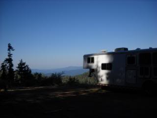
Today we had only a short 12 mile ride from Twin Bridges to Hwy 44 at Old Station. Burton picked us up and we trailered to the Heitman’s residence, a PCT haven. 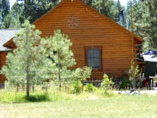
The Heitmans have been hosting PCT trekkers for years with everything set up for hikers. They loved the fact that Issy was going to mow their front yard. Although there wasn’t any pen for him, everyone watched after him and gave him attention.
Burton and I went to wash clothes and resupply the trailer leaving Issy in the care of the hikers and the Heitman’s. When we got back we were told Issy took a tour of the neighborhood but was promptly returned by a friendly horse lover. Issy is quite a sight with his white bug blanket on 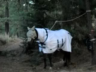
and his head net covering his whole head. So he looked like a big white ghost traveling around.
Firefly (Mrs. Heitman) tried to find a horse to ride with us tomorrow but was unsuccessful.Her friends with horses already had plans for their horses. It would have been fun to ride with this grand dame of the PCT – she is just a sparkle of energy and enthusiasm at 71 (I never told.) When we settled in we had electricity for our trailer which was a real treat and were fed a dinner of lasagna and corn on the cob. The Heitmans hosted 32 PCT people that night and Firefly told me that the first year they started they hosted 30 people the entire hiking season. This is really some feat since no money is expected although everyone tries to leave some donation to help with the tremendous costs. This slightly off trail treasure is rarely missed by hikers or horsemen alike and now I know why.
An update on the Heitmans: There was a serious forest fire in their area and they had to flood the entire area surrounding their home to safe guard it. Hikers have reported that they are safe but the fire is raging on.
July 23
Today we drove from the Heitmans to look at the Hat Creek Rim area, the southern most section of the Cascade Range. Visible to the south were snow capped mountains and the 10, 457 foot volcanic Lassen Peak.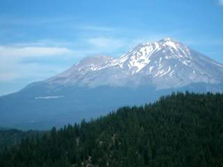
To the north was the snow covered Mount Shasta. 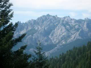
Between them were fascinating views of Hat Creek Valley. Traveling the Hat Creek Rim would mean going over dry, rough volcanic rock trails with no water for miles. 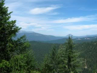
I decided to catch the PCT north of Hat Creek Rim at Hwy 299 tomorrow.
July 24
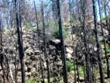
The PCT at Hwy 299 started dry and boring. The terrain was barren with much of the area still showing scars of the 1987 burn. 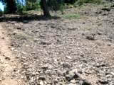
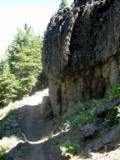
Shade or any other relief from the sun was non existent. Poison oak was the most dominate plant. Soon the lava ridges drew my attention. 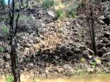
Solid walls of lava rose 20 to 50 feet and followed the east edge of the PCT for hundreds of feet. I hoped the trail wouldn’t climb the fault on the east.
It wasn’t long before the Shasta Trinity National Forests brought level passage. Oak trees pushed the border of private lands right up to the trail. Issy walked and trotted without urging, enjoying the ease of travel. His speed is 5.5 miles per hour in an extended trot so we racked up mileage until we got to an old rail line. The tracks had been taken up, but the track bed of crushed lava rocks was still obvious. I was really tempted to jump up on the right of way and see where it took us but decided not to since we still had to get to Burney Falls by afternoon. We continued along the edge of Pit River Canyon enjoying the luxury of shade from fir trees, pines and cedars. Soon we were along side of Lake Britton far below the trail.
We both looked for a way off the cliff to get some water, but the rise was just too steep. We came to an old road with a sign pointing down to a spring. Issy read my mind and pulled off the trail onto an old road at the edge of the cliff.
This “road” was rough and overgrown with washouts which just disappeared over the edge of the cliff. Issy moved forward as if the washouts weren’t there, but I finally dismounted. Issy must have smelled the spring as he pushed forward determinedly, but we came upon a trail stopper. 
A huge oak tree had fallen from the ridge above and was leaning completely across the trail and shooting out over the ledge 20 feet or so. This was an impossible tree to saw because it had many large branches holding it up over a wide washed out area. I tied Issy to it so see if there was a safe way around but it only got worse.
Apparently no one had been on this road for a very long time and it would remain untraveled. We couldn’t get past it. If camp was on the other side I would have spent the rest of the day cutting and clearing the tree, but camp was north west of this overgrown road. Only a drink of water from the spring would have been our reward, so Issy would just have to make a few more miles before he could drink. My extra canteen I carried for emergencies was full, so if we ran into problems I could give him that half gallon.
I turned Issy around and he resisted the direction change. I knew he was very thirsty, but in a few hours he would be able to drink all the water he wanted. Issy lugged as he always did when he was in need of water, but we pushed on. We continued through the trees to Hwy 89 and crossed into McArthur Burney Falls Memorial State Park. 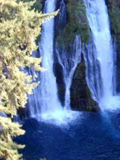
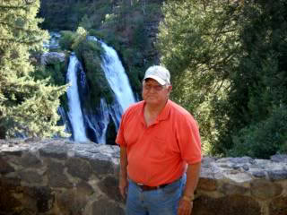
We traveled along side of Burney Creek and over a lovely bridge to a camp are that PCT goers called Head Waters. Head Waters was away from the public campgrounds and had a great 5 foot tall corral, drinking water and plenty of camping spots. Burton was already there and had a full water bucket in the corral for Issy. Issy was rewarded with lots of hay and plenty of room to walk around. Burton and I went over to the main campground to take showers and view Burney Falls. 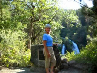
July 25-26
It was hard to leave Burney Falls and Head Waters.
I reconnected with many hikers we yo-yoed with on previous trails. One hiker in his 70’s nicknamed Turtle Bob was sitting at a picnic table, and he was covered with blood. Burton and I insisted we take him to the hospital immediately, but the tough, stoic hiker refused, saying he “just fell” and that his injury looked worse than it was. After all, he had to push on. The “pull” of the PCT affects everyone that attempts to get to Canada,
and that pull becomes stronger as the miles pass. So, we left Turtle Bob and wished him well.
I packed up Issy and headed out determined to cover 28 miles. 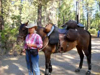
The guide book said the rocks we walked across in this section are 400 million years old. I couldn’t even try to put that into perspective. Issy moved out at a fine pace, and we followed Clark Road for a brief time with the sounds of Burney Falls escorting us.
We traveled up switchbacks, crossed roads and arrived at the head of Lake Britton Dam.
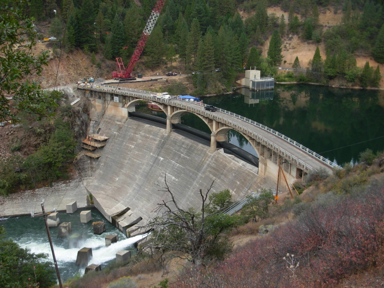
There was construction equipment on the far side of the dam, and the road across the dam was blocked off. The construction crew had built a temporary path over the dam and along the north wall of the lake from iron tee posts set in concrete and lined with chain link fencing. Although hikers had no trouble passing through the narrow lane, Issy couldn’t fit with his saddle bags on.
We got half way across and he just couldn’t move an inch farther. He immediately became frightened and panicked, pulling backwards, then running backwards. I had the bitless bridle on and it was worthless to stop him. Finally, there was a ridge of concrete which caught his hind heels and stopped him. I shutter to think what would have happened if that had not been there. We were on a dam! With horror in Issy’s eyes, I hurriedly unpacked him so he could fit through the ridiculously narrow lane. With the packs off, Issy passed several tee posts and started to settle. I was able to safely get him to a tree and tie him.
When I went back to gather up the pack, Issy’s eyes never left me. He whinnied and called as I got farther away. I hurried back and Issy’s head immediately dropped and he started to relax. Our bonds are much stronger than I realized. At some point Issy started to think of me as a member of his herd.
We headed toward the trail once again only to be forced off the road by a speeding black BMW with the driver shouting out its window “You don’t think I would have hit you do you?” I couldn’t wait to get back to the isolation of the trail. We had enough drama for a while.
On the trail we passed uneventfully into a gorge, on to Rock Creek Canyon then to the bridge over Rock Creek. 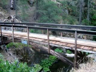
Several hikers were sitting below the scenic double tiered Rock Creek falls, but the water was inaccessible to Issy because of the steep loose slope. I called to one of the hikers and asked if they could fill Issy’s water bucket since there wasn’t any place I could have safely tied him. It didn’t take long for Issy to swallow two buckets of water, and the hikers were set to get more if needed. I took pictures of the far wall we had to climb and noticed that some hikers were taking Issy’s picture.
We traveled many waterless miles over ridges, into canyons and crossing abandoned roads as we worked our way up a long climb on narrow footing. We curved into a hollow, crossed more roads into an old clear cut section of the forest, then followed logging roads into the brush.
At Peavine Creek there was little water. Issy didn’t seem interested so we pushed on to Red Mountain. We crossed a portion of trail where the footing was non existent and dangerous. The falling scree invited horse and rider down the canyon wall to infinity. I held my breath as Issy followed me across, grateful no hikers were heading south on the same ledge. We continued through logged out forests disrupted by logging roads that pretzeled the scenery.
Both Issy and I became exhausted. When we crossed the road where Burton was to meet us we found no signs that he had been there. This was the first time Burton wasn’t at a camp site and already set up, so I thought I had the wrong road. Issy and I pushed on and traveled another 6 miles to Moose Creek Head waters.
As soon as we arrived I knew I had gone too far. It was 6 PM, and we had to go back several miles to find Burton at Bartle Gap. Issy did not like the direction change but followed reluctantly with me dragging him. We went back over that same dangerous ledge a second time and again, Burton wasn’t at the expected meeting place.
Now I was so very exhausted I couldn’t think, I turned Issy around, crossed that same treacherous ledge a third time and headed toward a logging road thinking Burton may have stopped there. Again, he wasn’t there. It was 8 PM and the sun was setting. Luckily, I had packed my tent and food for both of us so we were able to camp at Moose Creek. I loved this off trail campsite because the creek sounds serenaded my dreams. 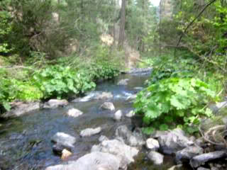
Even Issy rested well and didn’t fuss.
I expected some night visitors but no bears came to retrace footprints left earlier. I knew Burton would be upset, but we had agreed that if it turned dark I would just camp and try to find him tomorrow. Unfortunately for Burton, he continued to look for me until midnight (long after I was sound asleep). He finally gave up when it was apparent he would not be able to identify the correct road from the logging roads.
July 27
As I rose from my warm, comfy sleeping bag and tent, I realized Issy had not had water since 3 yesterday. Although Moose Creek ran along side our camp it was concealed by brush and boulders. 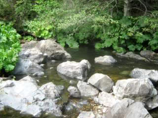
I was too tired last night to try to make my way to the water and opted to rest and see how the access looked in daylight. Good thing I waited because it was very rough and would have been far too dangerous to climb down in the dark. I walked a few hundred feet, found a bridge and was able to tie Issy’s bucket to the long rope that is a trail riding must. Basically I fished water out by throwing the bucket over the edge of the bridge , waiting to hear if it hit water (if it did) then hauled it (and lots of branches) back up to the bridge. I cast for water for over an hour since Issy drank every drop each time I brought it to him. With Issy satiated, I considered my options. I could continue on the PCT, but Burton would be looking for me 6 miles back and not at the next day’s trail head.
Or, I could backtrack yet another time. I decided to go back. And, this time I took the best road out and headed to Hwy 89.
I figured Burton would eventually have to come out of the mountains sometime, if for no other reason than to get diesel. Good choice, because within 10 miles of road travel I heard our big white dually roaring down the dirt road. Burton found out from a fellow who was heading in that I was hoofing it towards Hwy 89.
July 28
Last night Burton trailered us all the way back to Head Waters where Issy could have a corral instead of being tied all night. 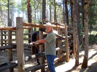
When I got up, Issy was standing there looking like he was in pain. I traced his back with my hands and didn’t find any sore spots then started down his legs and immediately found all four were swollen. No heat, but very enlarged and fluid filled legs were certainly a cause for concern. Issy was fit, really fit and the workout he had in the past few days shouldn’t have caused road founder or anything else. After all, I walked many miles so as not to over burden him. The only reason that seemed plausible was that I had left the boots and splint guards on over night and they must have restricted his circulation. We were forced into a day of rest if not more. Luckily, we were at Head Waters where we all could rest.
July 29
Morning brought Issy in fine spirits and his legs showed no signs of swelling. I was lucky I learned a lesson without Issy being hurt. I decided to push on towards Castle Crags and we trailered to the PCT at Squaw Valley Creek trail head. This was a great location although not a very desirable camping area for horses.
I saddled up Issy and rode south to Ah-Di-Na a camping site located at an old resort. It was worth the trip since it was located next to the McCloud River with picture book beauty. We turned back and climbed our way up then down to Squaw Valley Creek. Crossing the suspension bridge from this direction I was delighted with the scenery.
It was safely familiar and I relaxed and enjoyed the streams, pools and waterfalls. 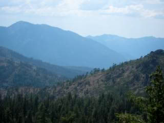
The spectacular bluffs jetted over the streams and hindered the water flow with frothing, white cascades. I felt like I was in Hawaii.